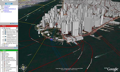
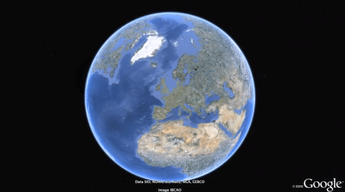
Google Earth

Fans of Google Earth have surely wished for a view of our planet from an astronaut’s perspective, and it seems that wish will be coming true thanks to an initiative announced Monday at the UK Space Conference in Warwick. The project will bring the first HD streaming video camera to the International Space Station where it will be installed and provide video of the Earth’s surface.

The camera will be built in the UK, and science minister David Willetts said the pictures will actually be better than in Google Earth. The project will involve Russia and Canada as well. The HD camera and a medium-resolution camera will be built and tested by the Science and Technology Facilities Council’s RAL Space department at the Rutherford Appleton Laboratory in Oxfordshire.

The cameras will be installed within a year on the Russian module of the ISS. The footage will be shown in almost real-time on the web. Canadian company UrtheCast, pronounced “Earthcast,” will be in charge of the web platform.

The HD streaming video cam will let you ogle over the Blue Planet as well allowing searches for videos of particular locations. You’ll be able to zoom in and out, and basically steer the camera from side to side. You can also rewind and fast forward as you investigate further into specific areas of the Earth. You’ll also be able to constantly track the location of the ISS to anticipate when it will pass over a particular location.

Willetts also said that the content will be viewable via smartphone, so we may be seeing a dedicated smartphone app in the near future.

It’s a pretty cool concept. We’ll be able to zoom into the Earth from space and check out what’s going on in real-time. Storms, rallies, outdoor concerts? The possibilities are really exciting.

via ZDNet
 
Google earth will soon enable one to take high definition virtual deep water trips as it will get data from Virgin Oceanic's submarine dives.

Source : Digit Magazine.
 
WASHINGTON: Citing the example of the 26/11 Mumbai terror attack, a top US military commander has warned of the dangers posed by "democratisation" of technology in future warfare.

"Now, in many ways, technology has been democratised," Marine Corps Lt Gen George J Flynn said at the sixth annual 2012 Joint Warfighting Conference at Virginia Beach Tuesday.

Referring to the greater availability of information potentially empowering conventional and non-traditional state actors, he cited a Harvard Business Review article detailing the November 2008 Mumbai terrorist attack as an example.

"All the mission planning was done via Google Earth," he said. "There was no investment in technology of [intelligence, surveillance and reconnaissance] platforms or anything like that."

Flynn said the terrorists used cellular phone networks as command and control and social media to track and thwart the efforts of Indian commandos.

"How much technology or how much investment was made to create that terrorist capability?" he asked.

The future operating environment -- both the technology and the threat -- will continue to increase at greater rates of change due to the accessibility of information, Flynn said.

"Space and cyber will continue to play an increased role in events, with each becoming increasingly contested domains -- so it's a new domain that we're going to have to contest."

"Security challenges will have both local and global aspects, we think, with events occurring across the globe,"he said. "So the bottom line [is that] if you liked the past challenges of the past 11 years, you will like the future."

./ TOI
 
Google Earth satellite imagery survey may have revealed two possible pyramid complexes in Egypt.
.
Satellite archaeology researcher Angela Micol of Maiden, NC said that the complexes were located about 90 miles apart, and contained unusual grouping of mounds with intriguing features and orientations.
.
One site located in Upper Egypt, just 12 miles from the city of Abu Sidhum along the Nile, features four mounds each with a larger, triangular-shaped plateau.

The two larger mounds at this site are approximately 250 feet in width, with two smaller mounds about 100 feet in width.

The site complex is arranged in a very clear formation with the large mound extending a width of approximately 620 feet-almost three times the size of the Great Pyramid.

"Upon closer examination of the formation, this mound appears to have a very flat top and a curiously symmetrical triangular shape that has been heavily eroded with time," the Discovery News quoted Micol wrote in her website Google Earth Anomalies.

Mysteriously, when zooming in on the top of the triangular formation, two circular, 20-foot-wide features appear almost in the very centre of the triangle.

Some 90 miles north near the Fayoum oasis, the second possible pyramid complex contains a four-sided, truncated mound, which is approximately 150 feet wide.

"It has a distinct square center which is very unusual for a mound of this size and it almost seems pyramidal when seen from above," Micol wrote.

Located just 1.5 miles south east of the ancient town of Dimai, the site also has three smaller mounds in a very clear formation, "similar to the diagonal alignment of the Giza Plateau pyramids," Micol said.

"The color of the mounds is dark and similar to the material composition of Dimai's walls which are made of mudbrick and stone," the researcher wrote.

According to Micol, both sites have been verified as undiscovered by Egyptologist and pyramid expert Nabil Selim.

Selim discovered that the smaller 100-foot mounds at the site near Abu Sidhum are a similar size as the 13th Dynasty Egyptian pyramids, if a square base can be discovered.

"The images speak for themselves. It's very obvious what the sites may contain but field research is needed to verify they are, in fact, pyramids," Micol said.

The researcher had previously located several possible archaeological sites with Google Earth, including a potential underwater city off the coast of the Yucatan peninsula.

She believes that the use of infrared imagery will allow scientists to see the extent of the complexes in greater detail.

The sites have been sent to Egyptologists and researchers for further investigation and "ground truthing," she said. (ANI)

source
 
Google-Earth-010.jpg


The Iranian authorities have long accused Google Earth of being a tool for western spy agencies, but now they have taken their attacks on the 3D mapping service one step further – by planning the launch of an "Islamic" competitor.

Iran's minister for information and communications technology, Mohammad Hassan Nami, announced this week that his country was developing what he described as an "Islamic Google Earth" to be called Basir (spectator in Farsi) which will be ready for use "within the next four months".

"Preparations have been made for launching our world's 3D map project and we are currently creating an appropriate data centre which could be capable of processing this volume of information," the semi-official Mehr news agency quoted Nami as saying on Tuesday.

Nami, a former deputy chairman of Iran's joint chiefs of staff and the armed forces, was appointed by President Mahmoud Ahmadinejad as the new technology minister in February. Nami, who studied political geography in Iran, is also a PhD graduate in "country management" from North Korea's Kim Il-sung University, according to local media.

"We are doing our best to launch the Islamic Google Earth in the next four months as an Islamic republic's national portal, providing service on a global scale," he added.

"On the surface, Google Earth is providing a service to users, but in reality security and intelligence organisations are behind it in order to obtain information from other countries," Nami said.


Read More: Iran plans 'Islamic Google Earth' | World news | guardian.co.uk
 
If you are a frequent traveler who loves taking snapshots with a mobile device which has geotagging capabilities, then you might find the new Google Earth update interesting. The new update to Google Earth for Android app lets users view geotagged Google+ photos directly within the app. The update is quite handy, if you want to take a look back at your travels in the past.

Users just need to sign into their existing Google account and tap the earth logo on the upper left hand corner which then pulls out the sidebar. You will notice a new section under ‘More Maps’ for Google+ photos.

Small thumbnail previews will also appear on top of Google Earth’s existing satellite imagery. A tap on the preview, and the app will launch a full screen slideshow that details everything saved in Google+ photo album or location. Basically, this new 7.1.2 version adds the ability to view all your geotagged photos from a new layer within the app, provided you’ve been uploading them on Google+.

In May, Google had updated the Earth app with Street View imagery, among other features. To use Street View imagery, users just need to zoom into a particular space that they want to have a closer look at. When a Pegman appears, simply drag and drop it into the street. Google also added better search and directions to help users find what they need and quickly get where they're going.
 
Google Earth adds 160 years of global temperature data

The new data lets users see how climate change has affected temperatures in almost any region of the globe.


Google Earth, which in 2009 unveiled tools to visualize the effects of climate change, has now gone one better.

The 3-D mapping program has now added data that will allow you to explore how much global warming has changed temperatures in your neighborhood or almost any other part of the world.

The new data layer (which you must add after downloading the Google Earth program) comes from the University of East Anglia Climatic Research Unit (UEA CRU), which has provided information from 6,000 weather stations around the world.

That's not all. Once you look at a particular location, the data also includes graphs with temperature records going back decades, and in some cases all the way to 1850.

Information is presented in boxes corresponding to every five degrees of latitude and longitude.

Dr. Tim Osborn from UEA CRU told The Guardian that "the beauty of using Google Earth is that you can instantly see where the weather stations are, zoom in on specific countries, and see station datasets much more clearly.

The data itself comes from the latest CRUTEM4 figures, which have been freely available on our website and via the Met Office. But we wanted to make this key temperature dataset as interactive and user-friendly as possible."

Dana Nuccitelli, one of The Guardian's "Climate Consensus" bloggers, tried the new system out, using the current Wintery Olympic Games as a starting point. According to the data, temperatures in Sochi, Russia, were flat from 1900 to 1990 but have risen nearly 1°C since then.

Slate's "Bad Astronomy" blogger Phil Plait also tried out the data by testing it for his home town of Boulder, Colo., where he found a 1°C rise over the past 15 years.

He also tried the Arctic, finding that "nearly everywhere I clicked in the Arctic the temperature jump in the past 10 years or so is larger and more obvious." (Plait also anticipates several complaints likely to emerge from global-warming deniers.)


Osborn acknowledges that the data has a few gaps where information hasn't been collected as thoroughly or for as long (the Sahara, for instance), and that the exactly locations of the weather stations may be off by a few kilometers if they didn't have the exact latitude and longitude coordinates, but he told The Guardian that he hopes people will let them know if any individual records seem "unusual."

In addition to the temperature information itself, Osborne and his colleagues have published a paper about the data in the journal Earth System Science Data.


Google Earth adds 160 years of global temperature data | MNN - Mother Nature Network
 
earth-pro.png


Google has just nixed the subscription fee for Google Earth Pro, dropping it from $400 a year to completely free. You’ll still need to get a key from Google to unlock the Pro features, but that’s a matter of filling out a quick form Google Earth Pro Account Self-Service . (Ignore the “free trial” bit in the URL; the new free license should work indefinitely.) Then you’d download the free Pro client from right here » Google Earth


Source»» Techcrunch.com
 
The whole world is now in your browser. Fly through landmarks and cities like London, Tokyo and Rome in stunning 3D, then dive in to experience them first hand with Street View. See the world from a new point of view with Voyager, which brings you stories from the BBC, NASA, Sesame Street and more. Start exploring: Google]Bad Request Earth[/url]
video: This is the new Google Earth - YouTube
 
Last edited by a moderator:
Back
Top Bottom
AdBlock Detected

We get it, advertisements are annoying!

Sure, ad-blocking software does a great job at blocking ads, but it also blocks useful features of our website. For the best site experience please disable your AdBlocker.

I've Disabled AdBlock