Google Maps Updates

ssparikshya

Member
Joined
2 May 2011
Messages
3,307
Reaction score
789
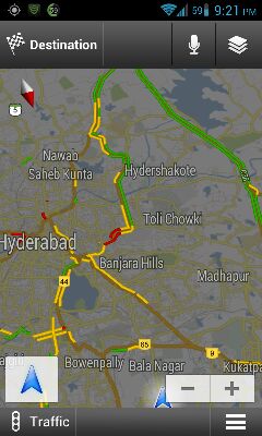
Google has updated its Maps app to version 5.8 for Androids. The update includes additional abilities for the Places and Latitude functions.

The latest addition, My Places, provides quick access to starred places, as well as those you've recently viewed. Additionally, you get an option to add new Places on the go, if they're not listed in Google Maps.

The new photo uploader lets users contribute photos to help others get a sense of the place. These submission may even become a profile picture for that place's page. Uploaders can manage these images by using the Photos for Google Maps album on Picasa.

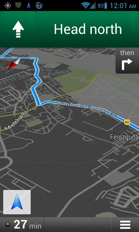
The new additions might be good, but I'm still waiting to see a much more important feature - offline navigation.

The update can be downloaded from here. Since Google likes to keep its goodies reserved for its own platform, the other OS (yeah, iOS), which also depends on Google Maps, is not going to get these features any time soon.


techtree
 
Now when you hover your mouse on any location on Google Maps, you will see current temperature and weather conditions of that place. Google is providing the weather information layer in coordination with weather.com and the US Naval Research Lab. To activate the feature, you need to click on the widget on the upper right corner of the Google Maps.
The new feature also tells you if it is day or night in that place via sun and moon icons. Google hopes the weather information layer help in making travel and activity planning more convenient. Apart from the current temperature, you will now be provided with detailed data such as current humidity, wind conditions and even weather prediction for the next four days.

You can also change the units of wind speed (Mph/KMph/Mps) and temperature (F/C), and enable or disable the clouds.
 
Google’s added a new feature to its Street View maps – 360-degree views of the interiors of establishments. Google had started a test program for this in April last year, and now, the fruits are visible for all to see. For now, shops, eateries and other establishments in Australia, Japan, New Zealand, and the United States (as well as the cities of London and Paris) have been able to invite Street View photographers to capture their interiors.
Speaking about the new feature, a Google spokesperson said:
"We've been seeing renewed interest in the past few days because, as promised, we're getting more imagery online. The 360-degree views are really visually engaging, so we're glad users are excited."
The aim is to provide immersive imagery so that potential customers can imagine themselves at the establishment, to aid their decision of visiting it. The feature should provide businesses an interesting way to bring customers into the store before they are even in the vicinity of it. The program is entirely voluntary, and for now, is still in its trial stages, with only a few select cities in each of the announced territories actually getting the chance to call over a Street View photographer. Google intends to start expanding the program’s reach soon however.
Street-View-Business-Photos.jpg

According to reports, Google is also directly offering establishments which are top-ranking on the site's searches the choice to add business photos to their Google Place page. The trial program is staying away from big brands, rather, will concentrate on smaller restaurants, hotels, shops and gyms.
Since the inception of Street View, concerns have been raised about the privacy of individuals in the images, whether at home, their workplace, or as bystanders. With the release of this latest feature, Google has announced it is blurring the faces of any bystanders to allay these very fears. The participation guidelines for Street View photography for businesses include the below information:
Business owners are told they must warn their customers and employees about the photoshoot before it begins. Google has promised it will blur out or refuse to publish any images that include bystanders.
The photoshoots will produce 360-degree images using fish-eye and wide-angle lenses as well as stills. Business owners are also invited to upload their own pictures.
Speaking about the project, a Google spokesperson told the BBC:
"Building on the Google Art Project, which took Street View technology inside 17 acclaimed museums, this project is another creative implementation of Street View technology, to help businesses as they build their online presence. We hope to enable businesses to highlight the qualities that make their locations stand out through professional, high-quality imagery."

Source : Digit
 
Apple is reportedly planning to incorporate its own 3D-mapping technology into iOS 6. Will rival Google beat it to the punch?

Google on Friday sent out invites for a press event next week in San Francisco where it promises to unveil "the next dimension of Google Maps," hinting it may also have some new 3D features on tap. The invite-only event is set for Wednesday, June 6 at 9:30 a.m. Pacific.

Google said it will give attendees a "behind-the-scenes look at Google Maps." The Web giant will also "demo some of the newest technology and provide a sneak peek at upcoming features that will help people get where they want to go – both physically and virtually."

The timing of Google's press event is significant because it's less than a week before Apple is set to kick off its annual Worldwide Developer Conference (WWDC). At the conference, Apple is expected to unveil the next major version of its iOS operating system, featuring a redesigned Maps application that no longer relies on Google's mapping services.

The most impressive new feature of Apple's new Maps app is said to be 3D mode, which could be added as an optional mapping layer, like the existing traffic, satellite, hybrid, and list layers.

Could Google also be getting ready to give its maps a 3D makeover? Signs point to yes, but we'll have to wait until June 6 to find out. PCMag will be on hand at Google's event to check out the new offering, so stay tuned for more info.

Google has already begun incorporating 3D technology into Maps. The Web giant last month added a new feature to Google Maps that lets users see 3D photo tours of more than 15,000 popular sites around the world.
.
 
Google seems to have finally launched voice navigation for Android users in the Indian market. Here is a video showcasing the functionality:


Update: Video is showing private for now but it is working now (before it didn't)

Pic:

gy2eteva.jpg
 
Last edited by a moderator:
RE: Google Maps for Android finally has voice navigation in India!

Thats good move by google.
 
RE: Google Maps for Android finally has voice navigation in India!

acha hai.. :)
 
Re: Google Maps for Android finally has voice navigation in India!

Google Navigation also shows live traffic...really awesome move


etapyhag.jpg


Street View can be used to see the world in Google Maps, but - up until now - users were forced to stay on land. That all changes today, as Google has added the very first under water panoramas to Google Maps - and they started with The Great Barrier Reef.


In a post on the Lat-Long blog, Google highlights some of the more notable things to check out, including a close-up of a sea turtle with a school of fish, a majestic manta ray, and - probably the most beautiful of all - The Reef at sunset.
There's a lot more to explore along The Reef, so pick a spot and enjoy the view.

Source
 
Last edited by a moderator:
Good maps really a great service on net.
 
Back
Top Bottom
AdBlock Detected

We get it, advertisements are annoying!

Sure, ad-blocking software does a great job at blocking ads, but it also blocks useful features of our website. For the best site experience please disable your AdBlocker.

I've Disabled AdBlock